Granite Flume Trail - Lower
Path of the Granite Flume looking east from the Aqua World Rock Climbing
area - c.2011 / Donald K. Winegar - Tintic Images
Brief history
The Granite Flume trail is nowadays divided into three separate
areas, upper, middle, and lower, each following the path of the old Utah Power Company water flume (also known as the Granite
flume), but now divided by sheer drops and wide spans in the rock outcroppings that were once bridged by the flume.
The path of the old flume runs on a gradual slope from just below the Stairs power plant
(about two miles up Big Cottonwood Canyon), to the mouth of the canyon along the north side.
Red line on the image above shows the original path of the Granite
Flume. Portions of the path now make up the Granite Flume trails. Map created using Google Earth - Copyright 2011 THAR & Google - Click on image for a larger view.
The original flume took water in from the tailrace or outflow at the Stairs plant, carried that water down-canyon
to a penstock that directly fed the Pelton wheel generators at Granite plant. Thus, the same water used to generate power
at two separate locations. The flume was roughly 1.5 miles long, passed over nine trestles, and through one tunnel.(1)
During
it's lifetime, the flume served it's original builders and subsequent owners well. That's not to say it didn't have issues.
More than once, a segment of the flume would would fail, releasing free-flowing water to cascade down carrying rocks, dirt,
and debris with it. Carving out a section of the hillside only to deposit the the material on the road or the creek bed far
below.(2)
It was not uncommon for small flows of water to escape the flume all along it's length. Though the drips and
trickles were of no consequence in the summer months, in the winter, these small flows would create massive icicles that would
hang from the bridgework and trestles. Sometimes dozens to over a hundred feet in length.(3)
The original flume, built in 1896 and constructed of wood, was rebuilt
and repaired a number of times over its 100+ year history. In 1998 it was replaced entirely by an underground metal pipeline,
a small portion of which followed the original flume path. Once by-passed, the old flume was dismantled. Most of the lumber
and metal being salvaged. Most that is, but not all. (More about that later.)
Getting there (Lower section trailhead)
With the building of the TAVACI subdivision on the north bench at
the mouth of Big Cottonwood Canyon, there is only one way to access the lower portion of the old Granite Flume path. The trail
is steep and switchbacks up the face of the north side foothills passing the "Tavaci Mines" and ending on the old
flumeway path at a popular rock climbing wall called "AQUA WORLD". Named, according to one of the climbers there
in April of 2011 when I was taking pictures, in honor of the old "AQUEDUCT" as they call it, that used to run right
where they and I were standing.
It is not a long
hike by any means, but as previously stated, it is up all the way, and very steep in places.
Red line on the image above shows the lower portion of the Granite
Flume trail and the penstock pipe path at the left. Also shown are the trailhead and Tavaci mine locations. Map
created using Google Earth - Copyright 2011 thrp & Google - Click on image
for a larger view.
|
Approx. G.P.S. Location:
|
40.37.147 N - 111.46.226 W (field) |
|
|
Approx. Elevation:
|
5122' (field)
|
|
|
30 x 60 Minute Map:
|
Salt Lake City, Utah
|
|
|
7.5 Minute Map:
|
Draper, Utah
|
|
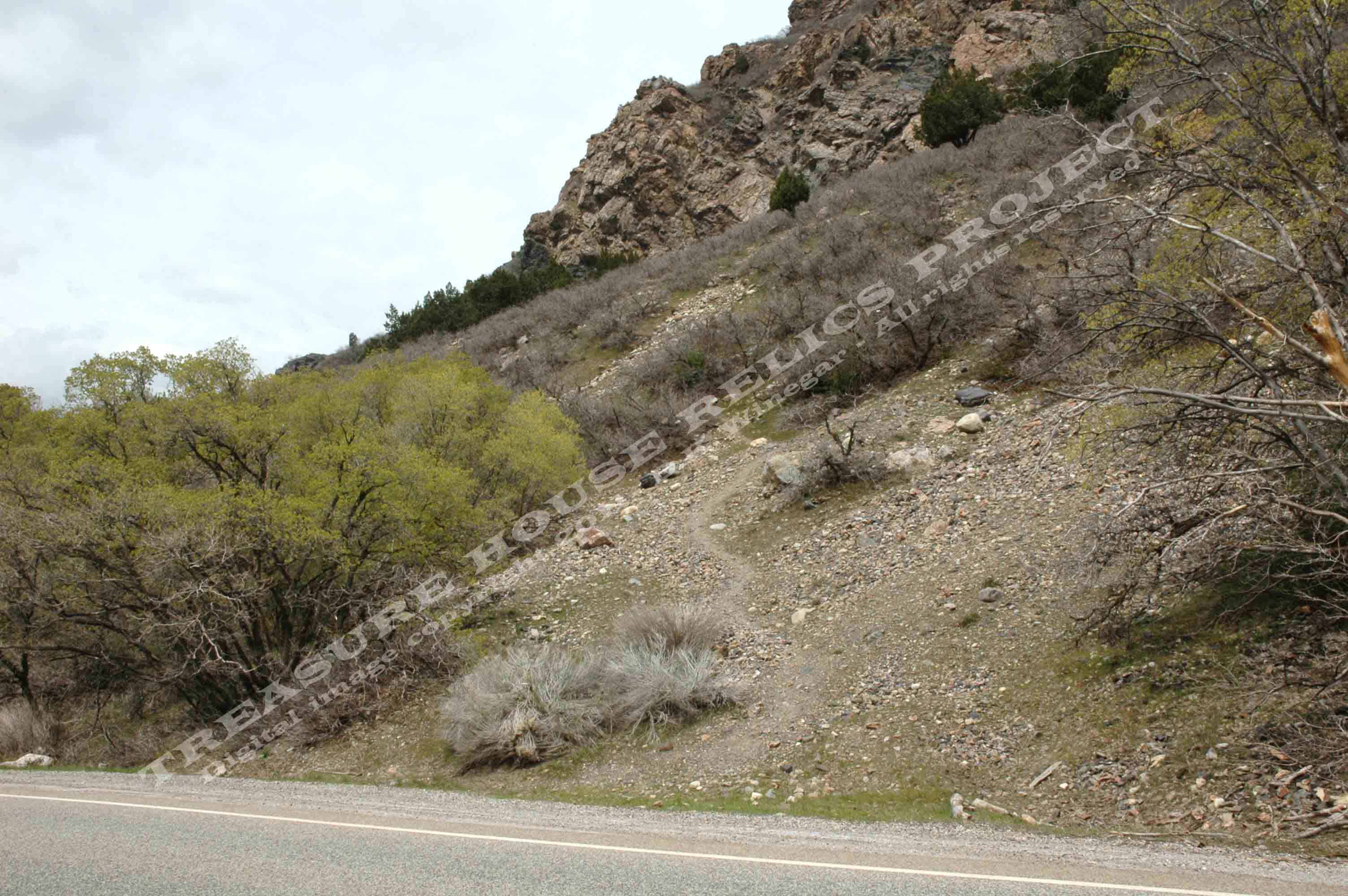
The lower trailhead begins just above the Tavaci entrance and the
gate that is sometimes used to close the canyon road. A short distance above the gate is a brown and white "Camping Prohibited"
sign. There is a small parking area along side the road, and the trailhead is directly across the street from the sign. It
is clearly visible and heads of in a northwest direction.
The trail is easy to see and rises quickly. It passes just below the
large dump of the upper Tavaci mine and then turns from a northwest direction to almost due north, switchbacking all the way
to the flume trail flat. (I always hike to the mine dump, cross over, and then connect with the trail on the other side.)
The trail meets the old flumeway path right at the base of the Aqua World rock climbing
area. Do not be surprised if you encounter a number of rock climbers at the top, they have been there almost every time I
have visited this site.
What remains
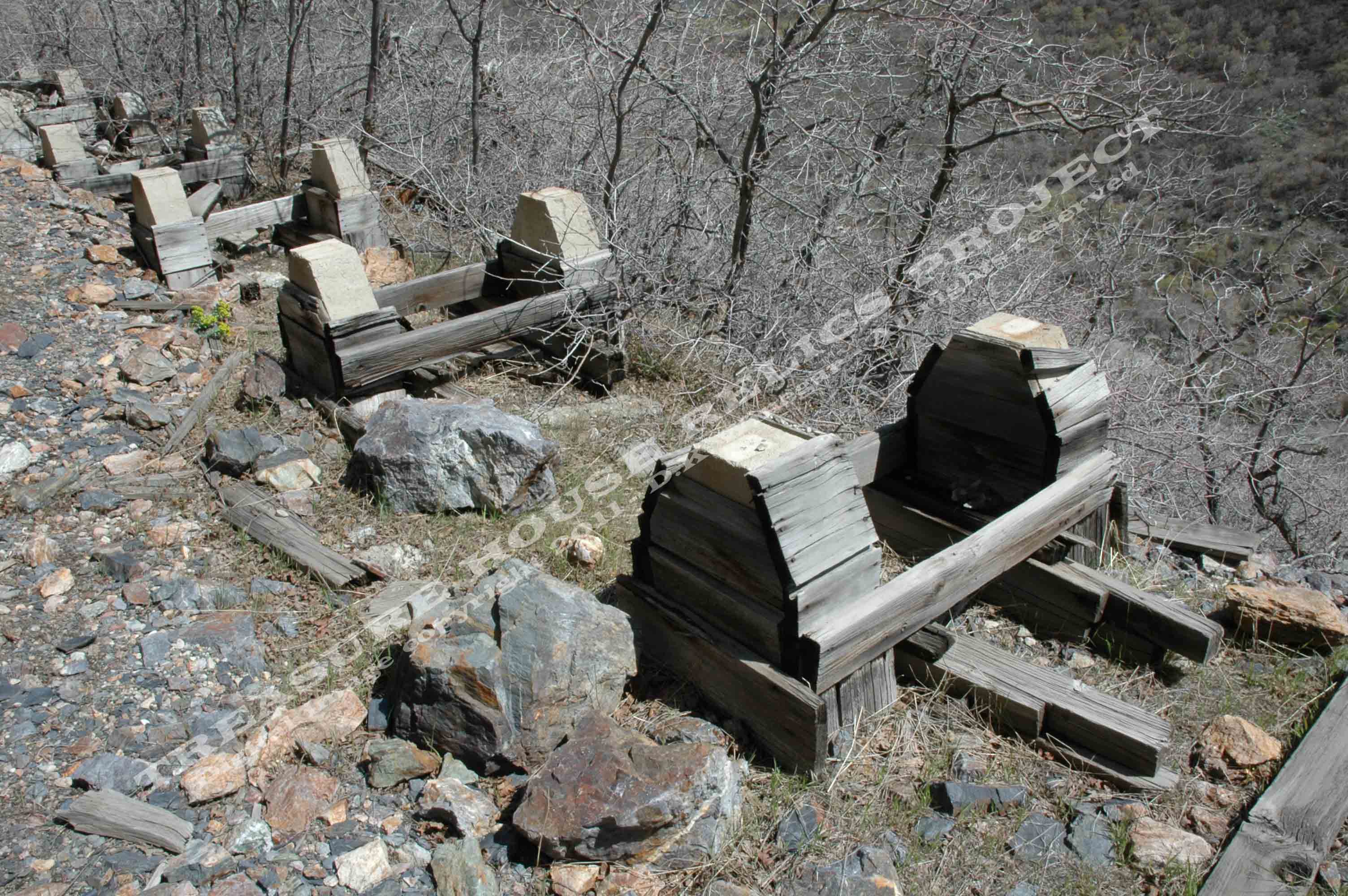
Concrete support piers of the old Granite Flume, some still encased
in wooden forms. - c.2011 / Donald K. Winegar - Tintic Images
Once at the top, to the right, a number of cement support posts are still in place, and in many instances, the wooden
cement forms are in place enclosing those posts. It is possible to hike the flumeway path a short distance to the east, though
it is heavily covered by rocks sluffing off the hillside above, use caution as it is a steep hillside below you.
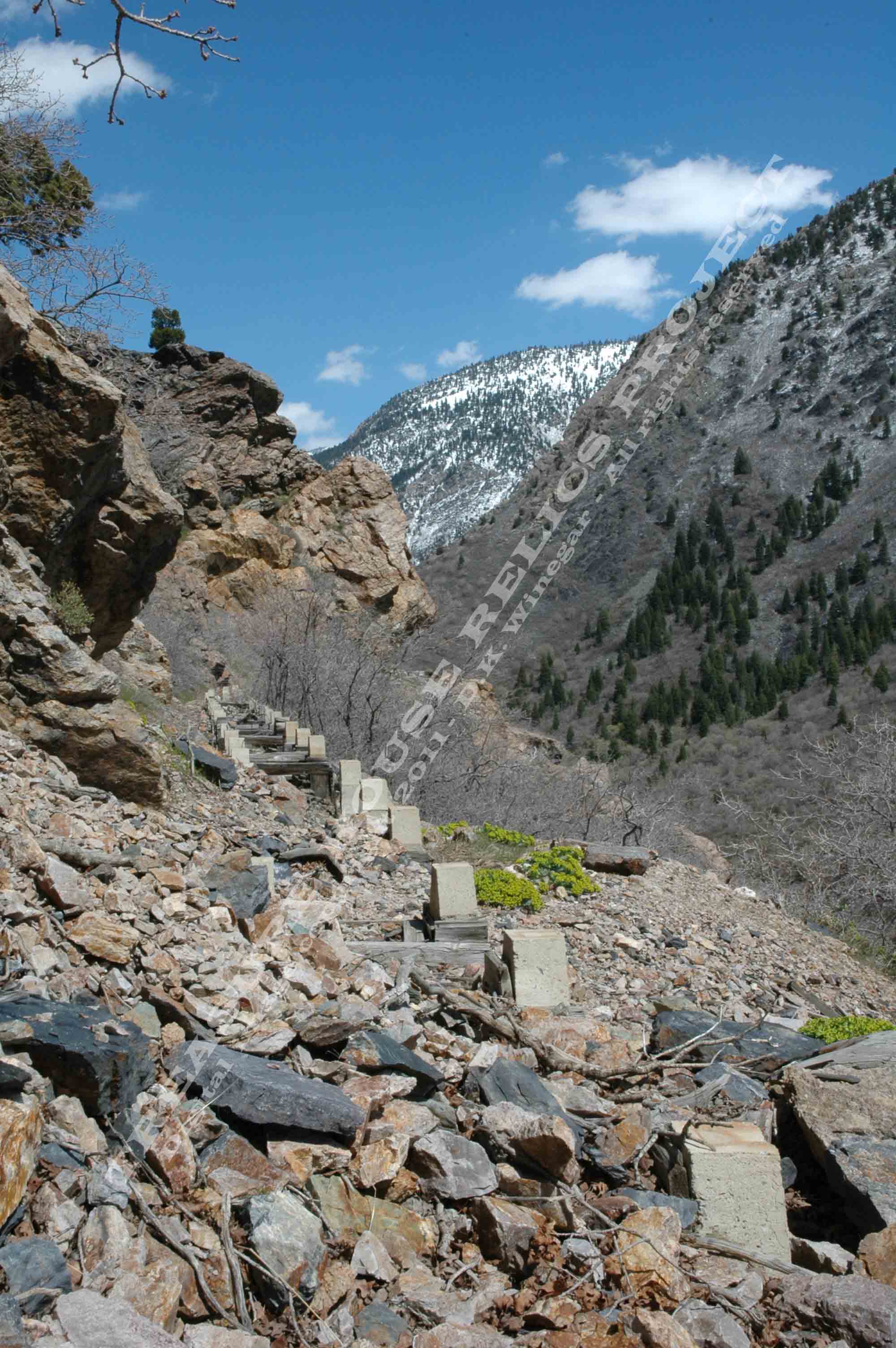
The eastern end of the lower flumeway trail terminates at a deep gap
in the rock, one of the places that was once bridged by the flume trestles. Now it is just an open chasm that cannot be crossed.
You can see the path of the flumeway in this middle section, but seeing it is all that you can do. It is dangerous to even
attempt to enter this sheer, steep, and dangerous "no man's land".
Enjoy the view, and snap a picture!
To the left, the trail dips into a shallow cut that can be crossed with some careful steps, and on the other
side a number of piers heading west. At a point, the piers stop and only a flat terrace follows the contour of the hillside
to the old penstock site. You will have a great view of the Salt Lake Valley, but where the trail transitions to a dirt road,
you must stop. You are entering private property at that point, and you may be ticketed if you proceed.
Again, snap some pictures, take in the view, and then head back.
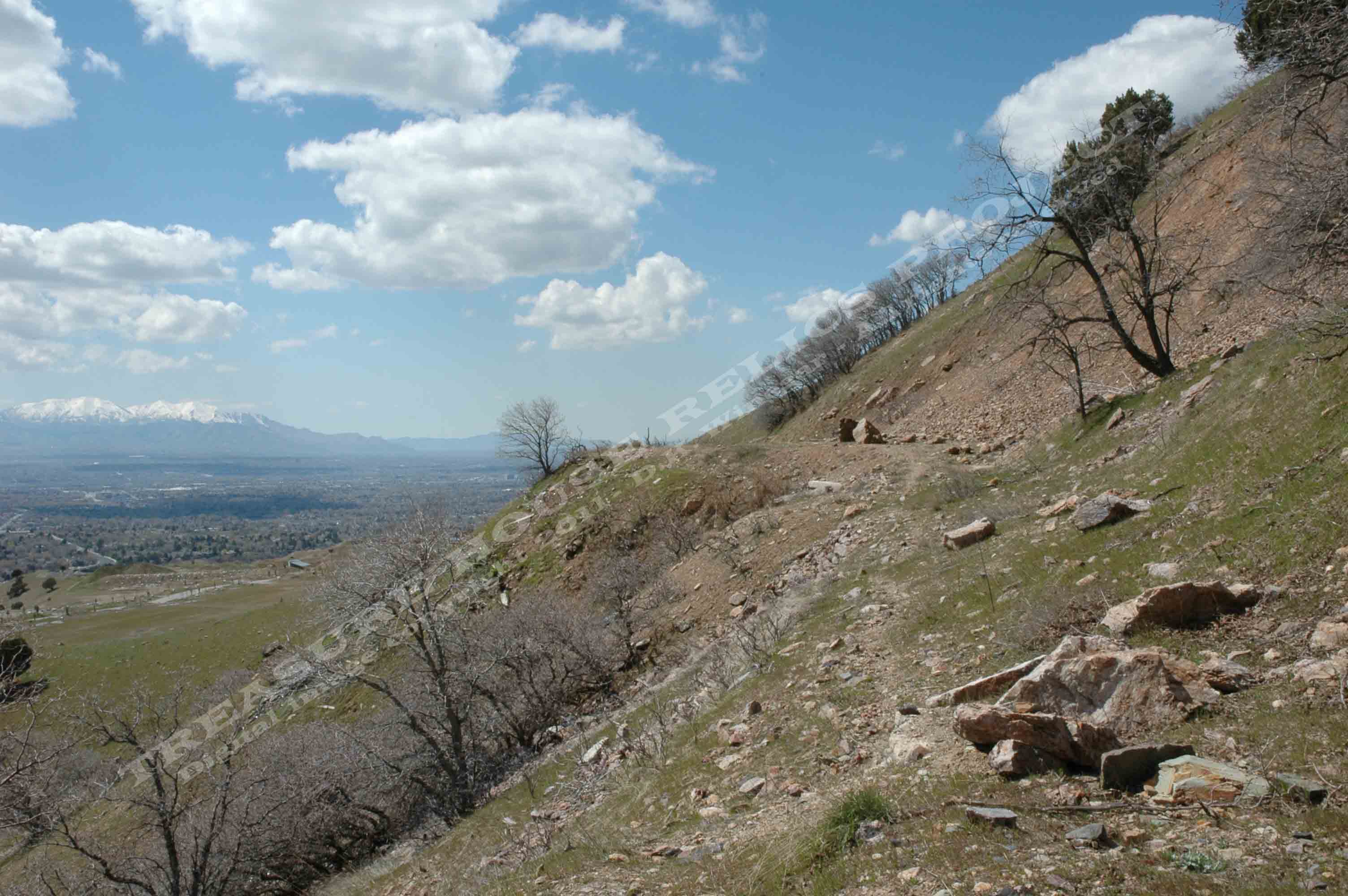
Lower Granite Flume trail looking west toward the old penstock
site and the west end of the trail at the TAVACI development property line. - c.2011 / Donald
K. Winegar - Tintic Images
References:
(1) Utah Power & Light - National Register of Historic Places Registration Form - NPS Form 10-900 - OMB No. 1024-0018,
March, 1989, Sec. 7, p. 9 "Conduit" - http://pdfhost.focus.nps.gov/docs/NRHP/Text/89000283.pdf
(3) Case, William F. - "Notable Utah Rock Falls in the 1990's and 1980's" - Utah Geological Survey - Open-File
Report 373 - October 2000, p.8 - http://ugspub.nr.utah.gov/publications/open_file_reports/OFR-373.pdf
(3) Scott, Merlin H., Personal communication, 1999
_____________________