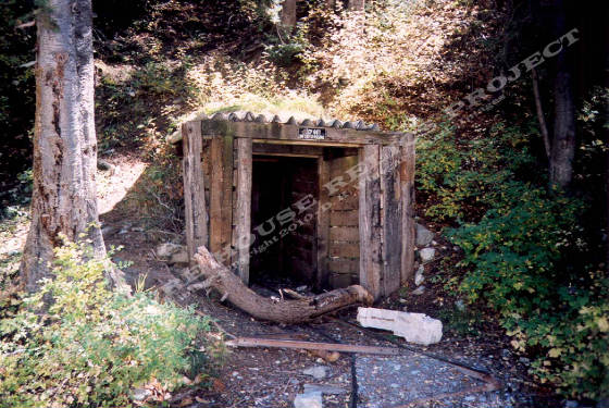
Portal of the Newman Mine on the south side of Big Cottonwood creek just above the Maxfield Mine site c.2005
Donald K. Winegar -
Tintic Images
Location data
QUICK LOCATION PATH: Utah / Salt
Lake County / Big Cottonwood District / Big Cottonwood Canyon / Canyon bottom above Maxfirld site
|
Approximate GPS Location:
|
40.38.485 N - 111.40.684 W (field) |
|
|
Approximate Elevation:
|
7040' (field)
|
|
|
30 x 60 Minute Map:
|
SALT LAKE CITY, UTAH
|
|
|
7.5 Minute Map:
|
MOUNT AIRE, UTAH
|
|
What remains
Only the timbered portal, a heavy steel gate that blocks access to
the mine, a few pieces of rail, and the long dump that parallels the creek and extends to the east remain at this site. No
structures remain standing at the Newman.
A
small amount of water issues from the heavily gated portal during springtime runoff, otherwise the dump and the portal area
are dry.
_____________________