| TREASURE BOX MINE c.2005 |
|
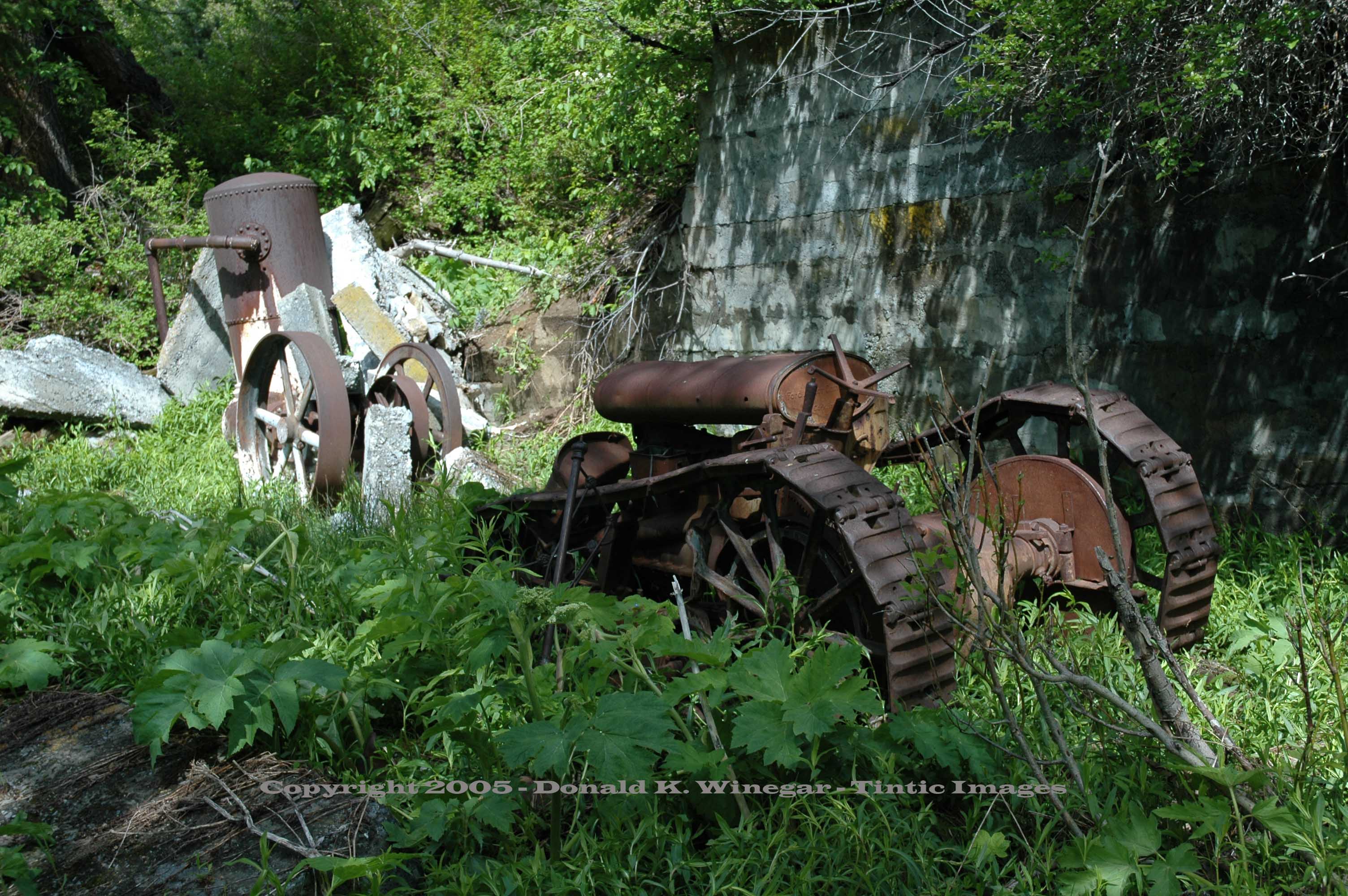
Tractor,
machinery and retaining wall at the Treasure Box mine. c.2005
Location data
QUICK LOCATION PATH: Utah / Salt
Lake County / Addams or hot Springs District / City Creek Canyon / Cottonwood Gulch
|
Approximate GPS Location:
|
40.49.979 N - 111.46.364 W (field) |
|
|
Approximate Elevation:
|
6827' (field)
|
|
|
30 x 60 Minute Map:
|
SALT LAKE CITY, UTAH
|
|
|
7.5 Minute Map:
|
FORT DOUGLAS, UTAH
|
|
Brief history
The Treasure Box Mining Company was one of the largest
mining operations in City Creek Canyon, it's large dump giving evidence to its reported 10,000 feet of underground workings.
Still, relatively few people know it even exists.
Located
in the early days of Utah prospecting, it was worked slowly and sporadically on two levels. Initial work was conducted
on the upper level some 250 feet above the lower portal. (Shown above) Assay reports and tonage are not known for this
earlier period, but most likely silver and lead were the primary metals being sought. Some data for the later period is known.
World War I brought an increased demand for zinc. With that demand, work
on the property resumed with vigor. By early 1918 more than 9000 tons of high grade ore was exposed in the upper level, and
a contract was let to extend the lower tunnel some 300 feet in hopes of striking that same rich vein at depth. Assays of this
ore showed 29 to 49% zinc, and 6 to 19 oz. of silver to the ton. In addition, selected ore samples showed more than 80% pure
lead. There is no report of the company ever striking that same rich vein, but it is likely that some ore was encountered.
Whatever the reports, the high grade ore was gone by January of 1919, and
the first in a long line of stock assessments was levied, 5 mils per share, due and payable by March. For the next decade,
with only one exception, every mention of the Treasure Box property in the Salt Lake papers was another notice of assessment.
That exception, in 1921, detailed the election of company officers. Last mention of the property in The Mining
Review, happened November 15th, 1928, with notice of a 5 cent assessment due and payable by December 3rd.
Getting there
From the trailhead at the top of Rotary Park in City Creek Canyon, hike approximately 1.25 miles to a point where
City Creek and the much smaller Cottonwood Gulch Creek join. Cross over Cottonwood Gulch Creek and immediately turn left (north).
A faint and heavily overgrown trail follows the old road .24 miles to a point where the lower dump is clearly visible
on your left. Cross over Cottonwood Gulch Creek again and your there.
What remains
A steam engine / compressor flywheel at the base of the dump near the creek. At the mine, the waste rock dump,
the partially collapsed adit with a moderate volume of water flowing from it. A steam driven compressor with cast flywheels,
a tall riveted tank, broken stone and concrete retaining walls, scattered debris, and best of all, a 1920's Model F track
drive, Fordson tractor built in Cork, Ireland!
Return to top of this page.
______________________


