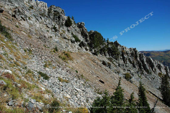
| TREASURE BOX MINE c.2005 |
|
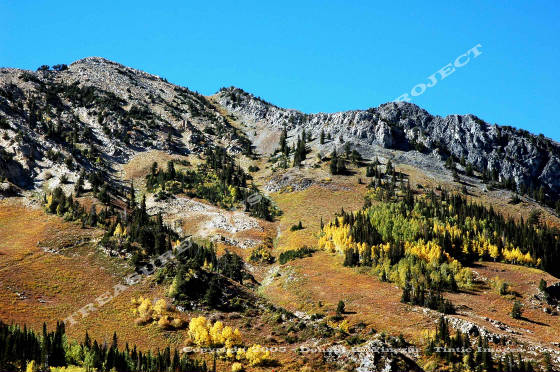
Carbonate mine dump is shown near the top center of this image - c.2005
/ Donald K. WInegar - Tintic Images
Location data
QUICK LOCATION PATH: Utah / Salt
Lake County / Big Cottonwood District / Mill D South Fork or Cardiff Fork / Kessler Peak
|
Approximate GPS Location:
|
40.37.361 N - 111.40.025 W (field) |
|
|
Approximate Elevation:
|
10,005' (field)
|
|
|
30 x 60 Minute Map:
|
SALT LAKE CITY, UTAH
|
|
|
7.5 Minute Map:
|
DROMEDARY PEAK, UTAH
|
|
Mineral Survey Plat
Below is a copy of the Mineral Survey Plat for the Carbonate Lode
Mining Claim, Big Cottonwood Mining District, Mineral District #5, Mineral Survey #45 Lot #81, dated October 4 & 5, 1877. The
original claim was 200 feet wide, and 1500 feet long, running East South-East to West North-West and encompassing 6.88 acres
of ground.
The Plat shows
the discovery marker near the center of the claim just west of the divide between Mineral Fork and Mill D South Fork just
south of Kessler Peak. At the time of the survey, the Carbonate Claim was being worked by a single open cut 51 feet long,
32 feet wide, and 22 feet deep on the Mineral Fork side of the divide, though later it would be worked by way of a tunnel
on the Mill D South Fork side.
There
was one stone cabin at the workings at the time of the survey that measured 16 x 12 feet, remains of which are still present
on the site.
Base Plat is from original scans by the U.S. Department of the Interior, Bureau of Land Management (BLM).
Modified
digital map image Copyright 2011 - THRP - Tintic Images
Detail From larger 1902 Cottonwood - American Fork - Park City Claim
Map showing the location and surrounding claims. - THRP - Winegar Collection
Brief history
The Carbonate mine
View of the underground workings as seen from the side of the Carbonate,
Sailor Boy, Homeward Bound, Baker, Defiance and Ebel groups. All were consolidated and worked under the name Kessler Peak
Mining Company - Detail from USGS Professional Paper 201, Plate 32 - Click on image above to se larger view - Digital
Image Copyright 2011 - Donald K. Winegar - Tintic Images
View of the underground workings as seen from above of the Carbonate,
Sailor Boy, Homeward Bound, Baker, Defiance and Ebel groups. All were consolidated and worked under the name Kessler Peak
Mining Company - Detail from USGS Professional Paper 201, Plate 32 - Click on image above to se larger view - Digital
Image Copyright 2011 - Donald K. Winegar - Tintic Images
What remains
Almost nothing. On the Mill D South Fork side of the divide at the old tunnel portal and tramway station, two
lengths of rusted rail hang down over the edge of the dump, the upper tramway station they once led to, is now long gone.
Old rusted cables from the tramway lay in place the entire length down the mountain side, but no towers remain standing.
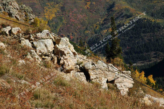
Tramway cables of the old Carbonate line running down the east slopes
of Kessler Peak. Though the rusted cables remain, no towers remain standing. Gone too are the upper and lower loading stations -
c.2005 / Donald K. WInegar - Tintic Images
On the Mineral Fork
side of the divide, stone walls of two structures remain at the original Carbonate site. One appears to be the very cabin
described in the 1877 plat, as the dimensions are the same. The smaller one, north of the first, is a partial dug-out style
cabin. Little except the stone portions of the cabins remain, and most of that, fallen walls as seen in the view below.
| TREASURE BOX MINE c.2005 |
|
View of the Homeward Bound Tunnel dump on the Mill D South Fork side
of the divide. The Homeward Bound began as a separate claim from the Carbonate but in time all Carbonate ore would be moved
through this tunnel. The old mine rails stick out from the covered portal - c.2005 / Donald K. WInegar
- Tintic Images
Almost nothing. Two lengths of rusted rail hang down over the edge of the dump, the upper tramway station they
once led to, now long gone. Old rusted cables from the tramway lay in place the entire length down the mountain side, but
no towers remain standing.
Stone bases of two small miners cabins are still
present about 30 yards south of the dump, but the stones are only stacked about 2 feet high anymore. The rest of the wall
fallen down, the upper portion of wood, lies scattered and rotting on the hillside below.
View of the stone wall remains of the larger cabin at the Carbonate
site - c.2005 / Donald K. WInegar - Tintic Images
_____________________