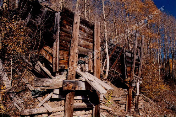
Twin ore bins or load-outs of the lower level of the Utah Cloud workings c.2003
Donald K. Winegar - Tintic Images
Location data
QUICK LOCATION PATH: Utah / Salt
Lake County / Big Cottonwood District / Big Cottonwood Canyon / Scott Hill
|
Approximate GPS Location:
|
40.37.159 N - 111.33.626 W (field) |
|
|
Approximate Elevation:
|
9646' (field)
|
|
|
30 x 60 Minute Map:
|
SALT LAKE CITY, UTAH
|
|
|
7.5 Minute Map:
|
BRIGHTON, UTAH
|
|
What remains
Two ore bins remain standing at the lower levels, and partial ore bin remains can be found at the upper levels.
A small metal covered shed or bunkhouse from the 1940's or 1950's stands on the property at one of the upper levels. All portals
to the underground workings are caved or blocked.
_____________________