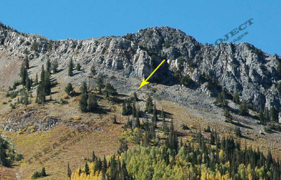
Bearson Mining Claim - BCC
Arrow shows the Bearson Mine dump on Kessler Peak - c. 2005
Copyright 2005 - Donald Winegar - Tintic Images
Location data
QUICK LOCATION PATH: Utah / Salt
Lake County / Big Cottonwood District / South Fork or Cardiff Fork / Kessler Peak
|
Approximate GPS Location:
|
40.37.440 N - 111.39.890 W (topo approx.) |
|
|
Approximate Elevation:
|
9666' (topo approx.)
|
|
|
30 x 60 Minute Map:
|
SALT LAKE CITY, UTAH
|
|
|
7.5 Minute Map:
|
DROMEDARY PEAK, UTAH
|
|
Mineral Survey Plat
Below is a copy of the Mineral Survey Plat for the Bearson Lode Mining
Claim, Big Cottonwood Mining District, Mineral District #5, Mineral Survey #54, Lot #90, dated December 22 & 23, 1877. The
original claim was 600 feet wide, and 1500 feet long, running North North-East to West South-West and encompassing 19.60 acres
of ground.
The Plat shows
the discovery marker near the center of the claim on the East slope of Kessler Peak below the Carbonate and adjoining the
Homeward Bound and Baker Claims. At the time of the survey, the Bearson Claim was being worked by 1 shaft and 1 open cut.
The shaft was 4 x 6 feet across and driven to a depth of 40 feet by that time. The open cut was much smaller, only 8 x 16
feet, and just north of the shaft.
There
is no mention of cabins or structures on the plat, and I have not yet visited this site.
Base Plat is from original scans by the U.S. Department of the Interior, Bureau of Land Management (BLM).
Modified
digital map image Copyright 2011 - THRP - Tintic Images
Detail From larger 1902 Cottonwood - American Fork - Park City Claim
Map showing the location and surrounding claims. THRP - Winegar
Collection
What remains
According to others who have visited the site, only the shaft and
the cut mark the site. No structures remain standing.
______________________