The
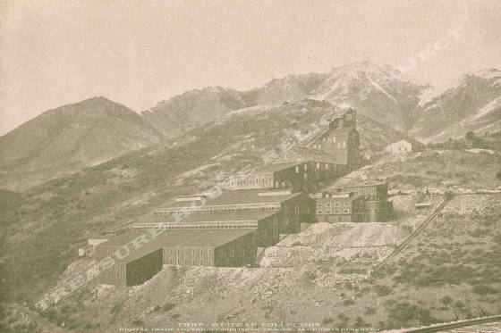
Golden Gate Mill in Mercur, Utah - THRP - Winegar Collection
Location data
QUICK LOCATION PATH: Utah / Tooele
County / Camp Floyd District / Mercur or Lewiston Canyon / Mercur
|
Approximate GPS Location:
|
40.19.340 N - 112.12.306 W (topo) |
|
|
Approximate Elevation:
|
6963' (topo)
|
|
|
30 x 60 Minute Map:
|
RUSH VALLEY, UTAH
|
|
|
7.5 Minute Map:
|
MERCUR, UTAH
|
|
Brief history
The Golden Gate Mill was the largest mill in the entire
district. It was the first mill in the state to be electrified using power from the Telluride Plant near the mouth of Provo
Canyon, and it would be a landmark for decades.
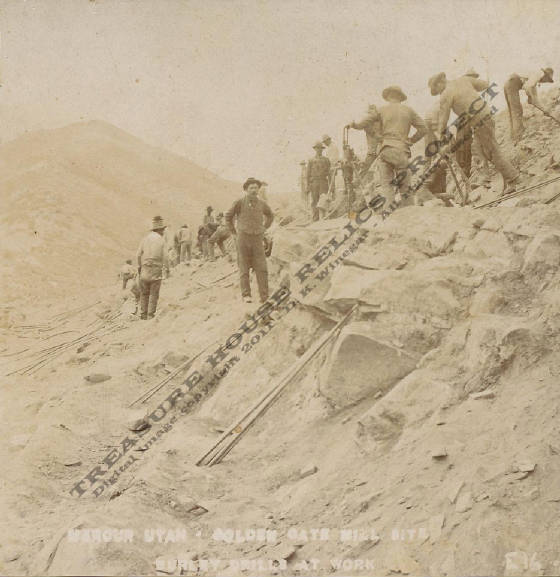
The
image below is from a stereo-view showing "BURLY DRILLS AT WORK" as men are excavating the hillside for
foundations of the Golden Gate mill.
Getting there
Mercur Canyon is closed to access at this time.
What remains
Only the foundations of the old mill remain
today.
Land
all around the foundations was open pit mined by Barrick-Mercur and other companies and is now in the process of being reclaimed.
Once the reclaimation work is complete, those foundations will remain at they are already listed on the National Register
of Historic Sites. As such, they have been protected. it is not known how accesible the site may be after the reclaimation
work is complete.
______________________